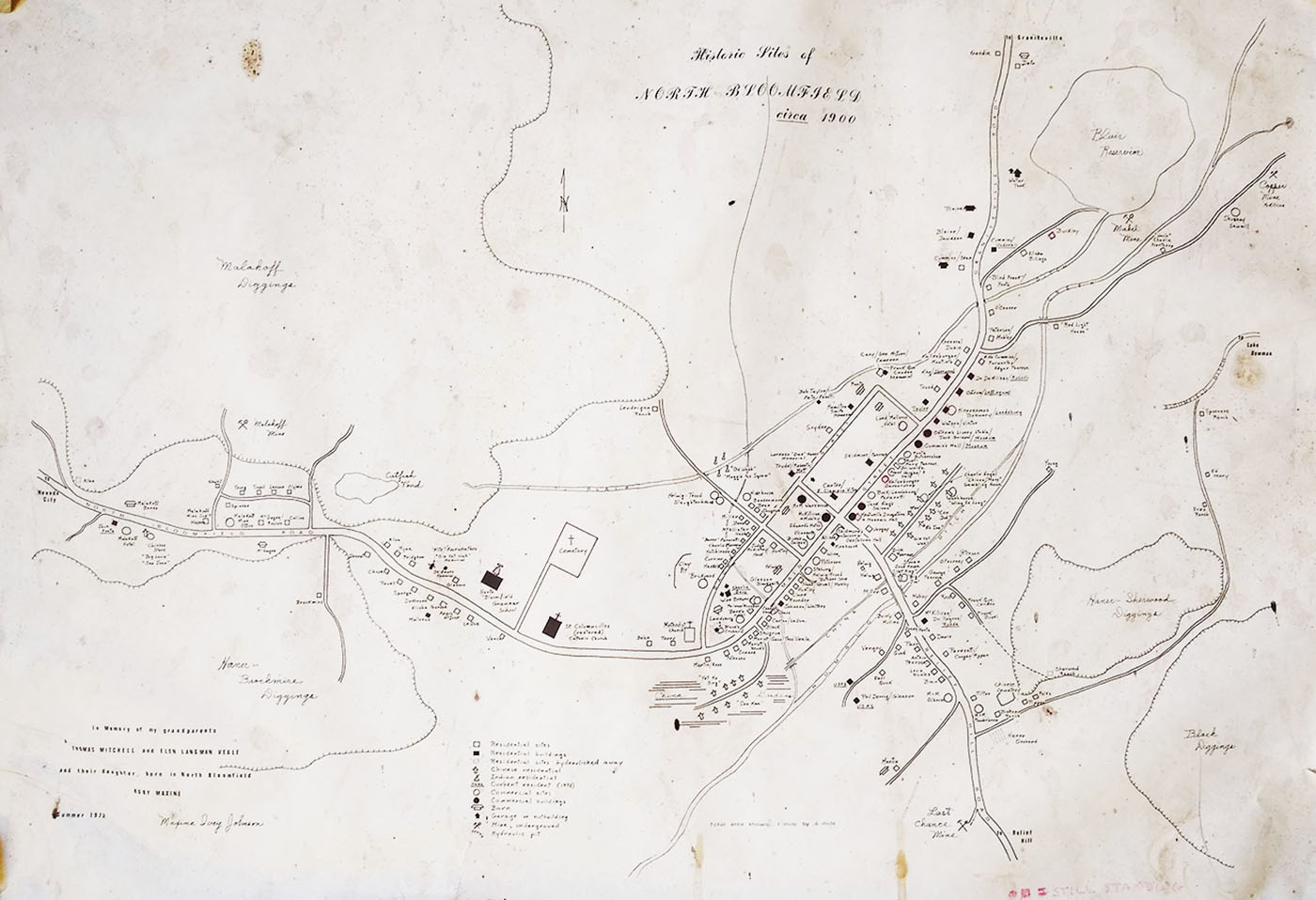
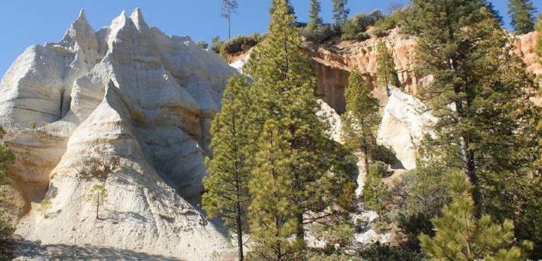
The area known as Malakoff Diggins is actually nestled within the town that used to be known as North Bloomfield. North Bloomfield is no longer a town but instead, is all encompassed in what is known today as Nevada City.
North Bloomfield was the site of one of the largest hydraulic mining operations in the nation. Washing away acres and acres of hillside in the search for gold.
Malakoff Diggins was the largest hydraulic mining operation in the world. The park is in total 3,000 acres and contains some wonderfully preserved historical architectural areas as well as trails and a campground. The park was added to the California State Park system in 1965.
* Address:
23579 North Bloomfield Road Nevada City, Ca 95959
* Phone: (530) 265-2740
* Reservations: : 800-444-7275
* Elevation: 3317 Feet
* Established: 1965
* Size: 3143 acres
Day Use Fee:
$10 per vehicle
$5 in off season
Season:
Year Round
Park Hours:
Sunrise to Sunset
Dogs:
Allowed on leash &
attended at all times
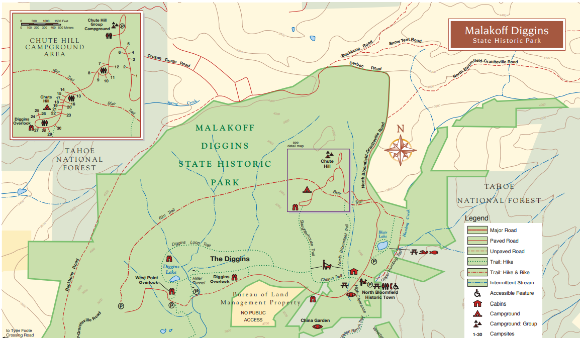
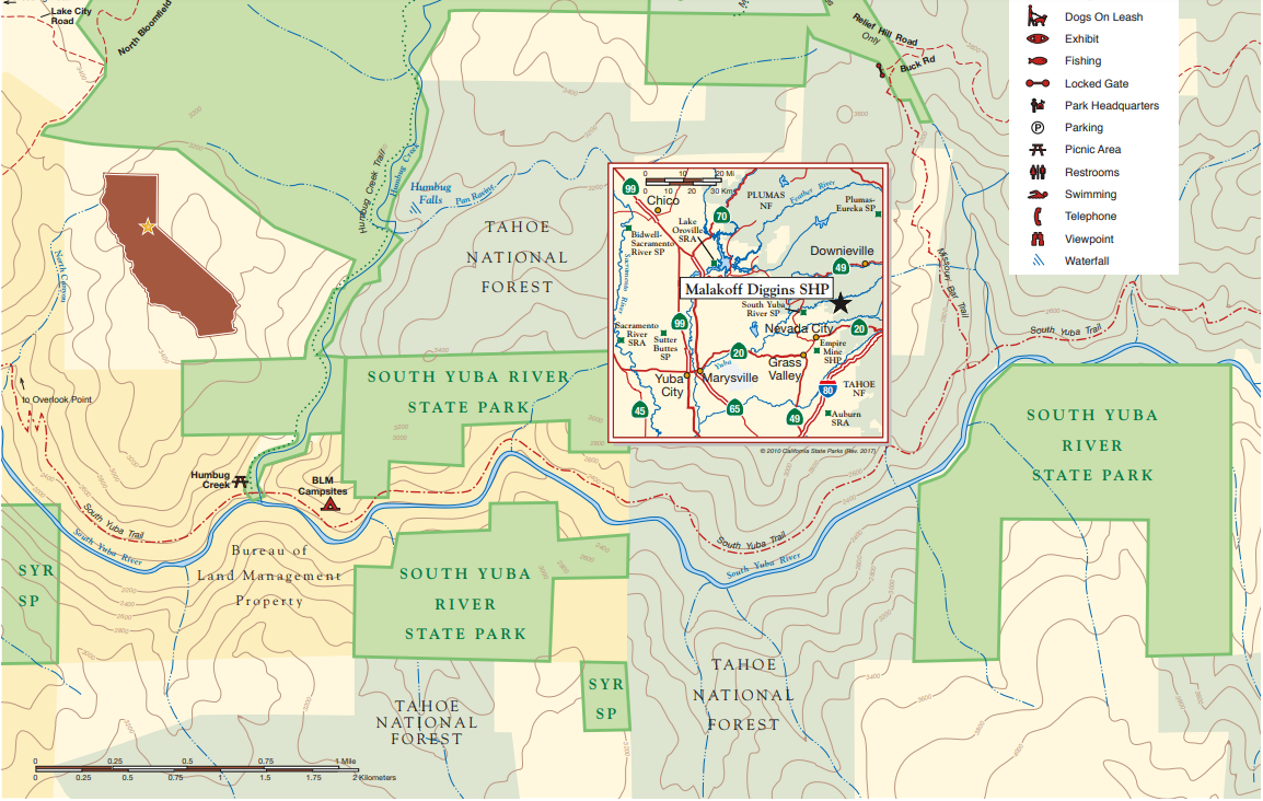
Park Map:
Historical Town:
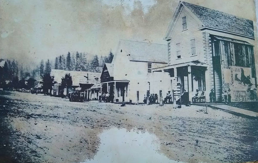
Historical North Bloomfield
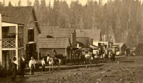
During the height of activity, the town had an estimated 1,500 residents and boasted over 200 buildings. There were 2 livery stables which kept the carriage horses for hire. At least 8 saloons, one of which you can see still the foundation for.
There were 2 dry goods stores which sold things like tobacco, sugar, flour, coffee and also textiles, ready-to-wear clothing. Basically nothing that contained liquid. A few breweries, boot makers and butchers. 2 churches and the school, plus a multitude of other buildings and businesses that made up the town of North Bloomfield.
The General Store and Post Office:
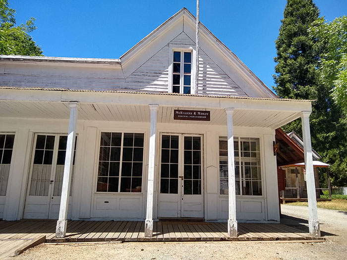
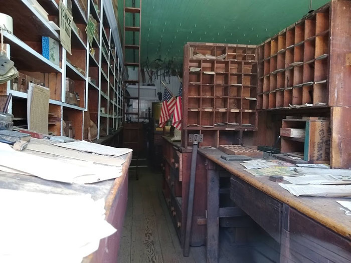
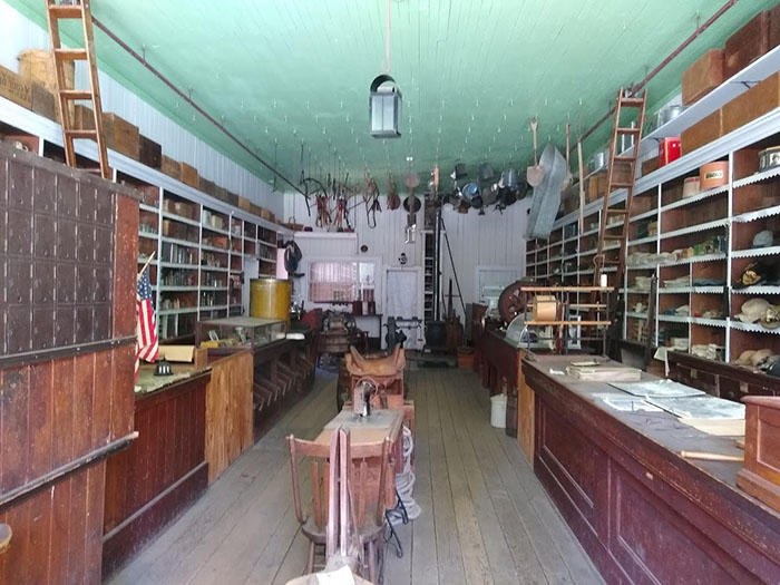
McKillican and Mobley dry goods store and general merchandise. This fascinating store which was built in 1956 holds relics of the past from a wedding gown, shoes, fabric by the yard, saddle supplies and soaps.
They also supplied kerosene for lamps, ammunition, hardware, mining supplies, stationery, kitchen utensils, paint, some medications, eggs, oranges and bakery goods such as cookies, chocolate éclairs, fig bars, gingersnaps, etc. Canned meat, cured meats, deviled ham and dried foods.
Not only did they supply the town with goods, but they served as the local post office and also as the local gold exchange and a drop-off. There was a security guard who would sleep there overnight.
On the days that the park allows people into see it, I highly recommend that you visit it. It will take you back in time.
Blacksmith:
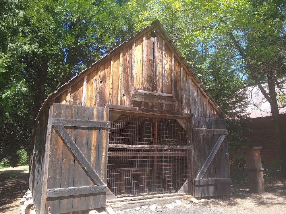
On the same side of the street as McKillicans is Glassons Blacksmithing. He would have made horseshoes as well as parts for the water monitors used in the mining operations.
Between the two buildings used to stand Edward's Hotel, O'Conners (residence) and Biven's Saloon. To the left of this building you would have seen Weise Brewery and the Berk Hotel plus a few homes mixed in.
Carter House:
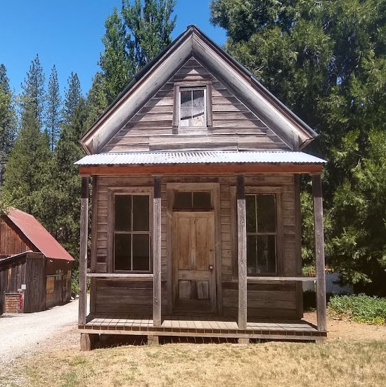
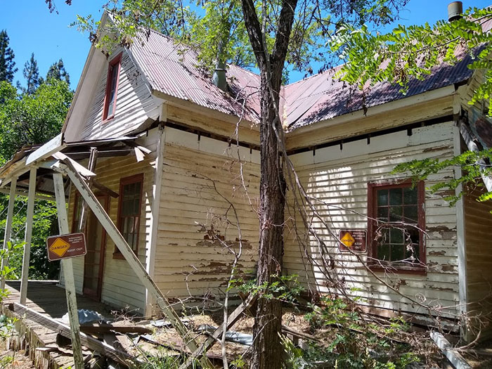
Heading up the same side of the street but towards the central part of town stands the Carter House. This building is the oldest structure in town, this place was a hotel in the early 1850s.
You can still walk up on the front porch and peer into the windows. It's not in the best of shape but for over 170 years old, it's holding up well.
The Skidmore House:
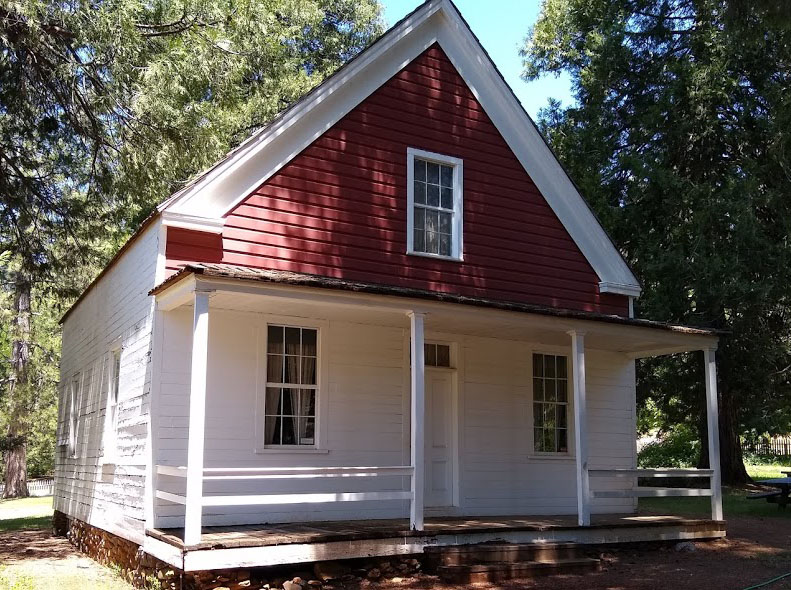
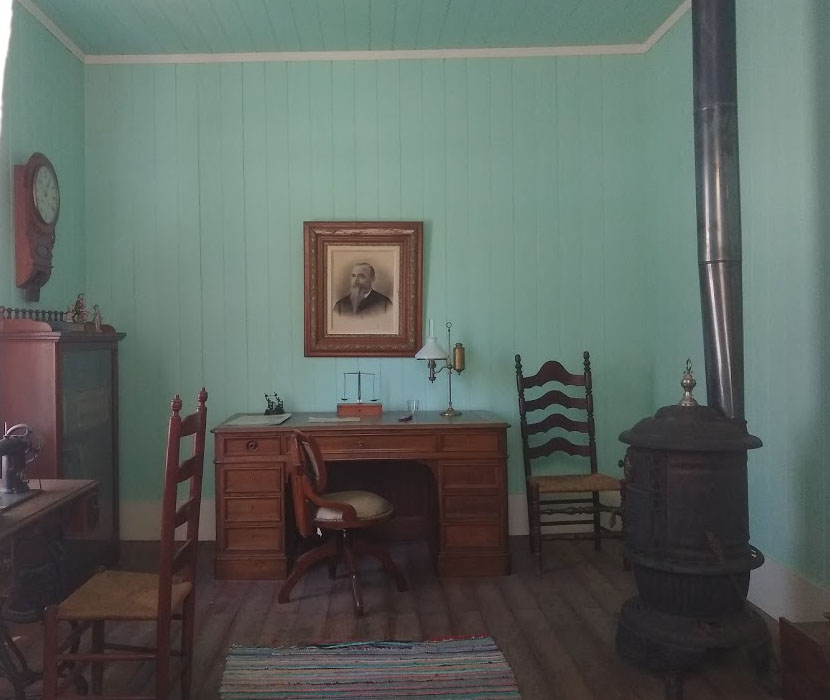
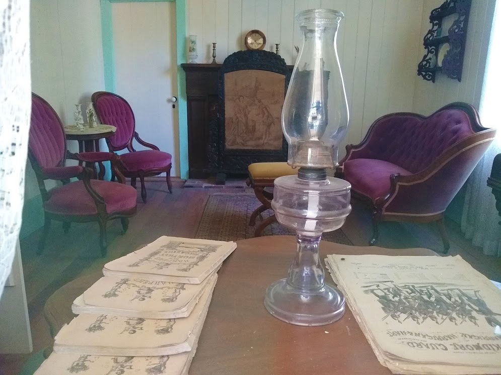
Next home in the same direction is the home of Mr.Skidmore. It's incredibly well-preserved and is completely furnished. It also contains a full walk-out basement.
Mr. Rush Skidmore was a well-to-do businessman with many ventures in the town. He and his wife Mary bore 5 children in that house. Mr. Skidmore died at his home on August 2, 1911
You will see the basement remains of the saloon that was owned by Rush Skidmore across the street from the McKillican and Mobley General Store. On that same lot as the house used to stand a hotel, now long forgotten.
Knotwell's Drugstore:
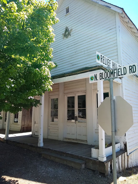
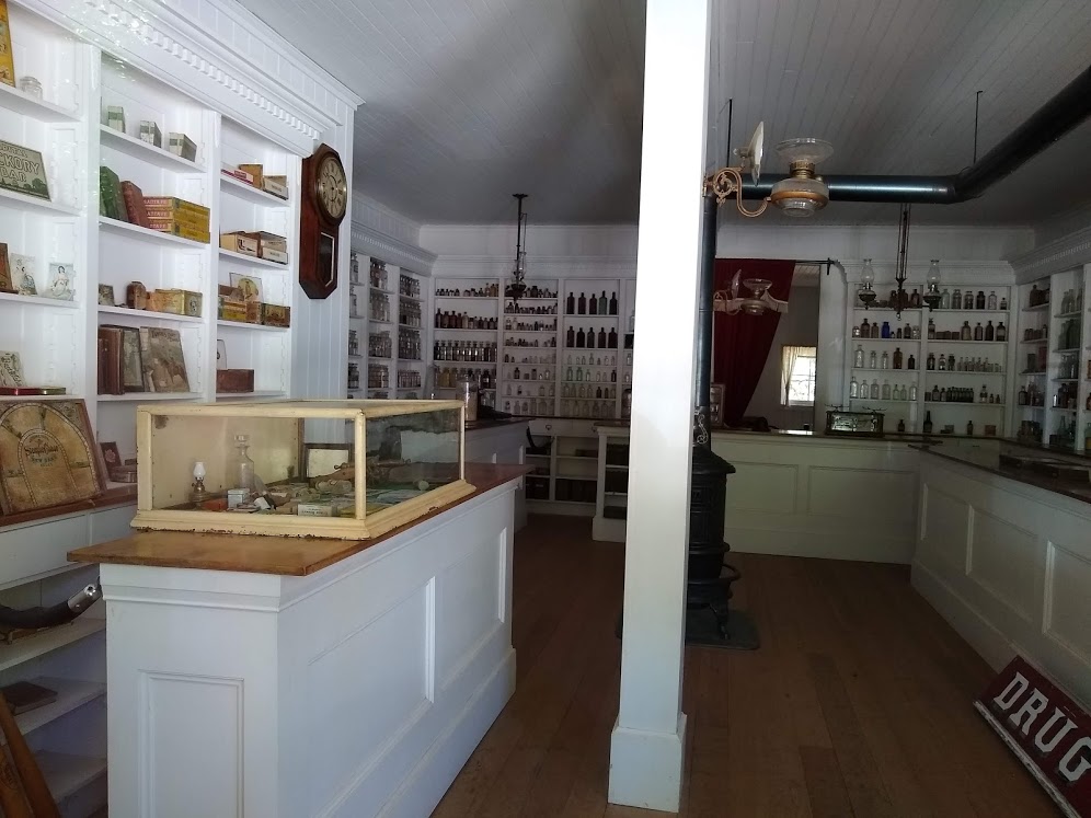
Knotwell's Drugstore is located across from the Carter house. This place is pretty amazing to see. Originally owned and operated by Adrian A Smith, he purchased the lot in 1874 which at that time it had a small home on the property. He converted the home into a drug store but he also sold things like perfume, soap, cigars and fancy plates.
Just like the King's Saloon, this building is not an original but a replica of the original. The original was torn down as it was inhabitable and the new one was constructed in the early 70s.
The King's Saloon:
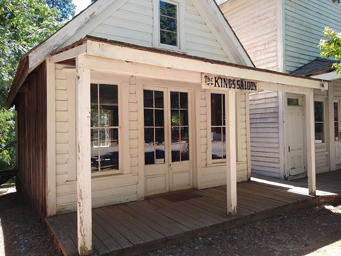
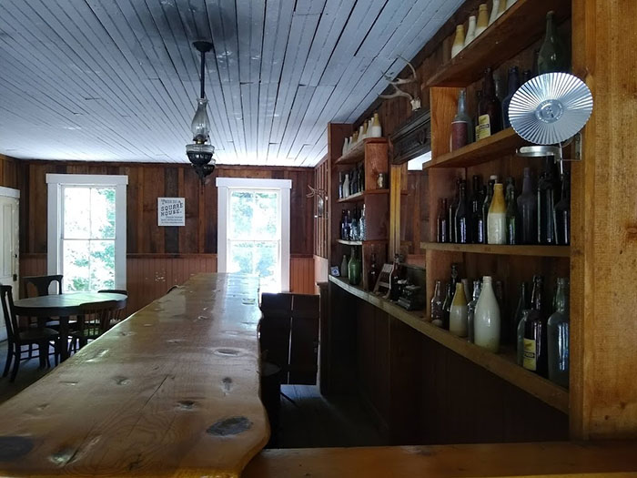
The King's Saloon also known as Jack Kings Saloon is located right next to Knotwells Drugstore. This particular building was originally built in 1860 and at that time it was an express office. When Jack acquired it, he remodeled it into a saloon. This was some time in the early to mid 1870's. Jack's saloon was one of many saloons in the North Bloomfield town.
The building where the "current" King's Saloon is, is in fact not the original building but one that was reconstructed in 1974 with the help of photographs and the local E. Clampus Vitus, Chapter 10 of NevadaCity.
Sadly, it too is in disrepair. If you walk around back, you will see the back stairs falling off.
St. Columncille’s Catholic Church:
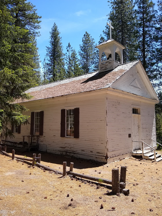
The church was not originally here but actually located in the township of Birchville which was about 15 miles from North Bloomfield. The town of Birchville no longer exists. This structure which was built in 1865 was used by the Bridgport Union Guard, which was an armory where they recruited and trained men for the Civil War. This lasted until after the Civil War.
Eventually becoming St. Columncilles Catholic Church in 1869 when it was purchased by Father Dalton. It was actively used as a church until the 1955 then it was left to time and decay. Saved from demolition in 1969, when it was moved to its current location in 1971 as a gift to the State of California from Mr.Bart Pinaglia out of North San Juan.
North Bloomfield School:
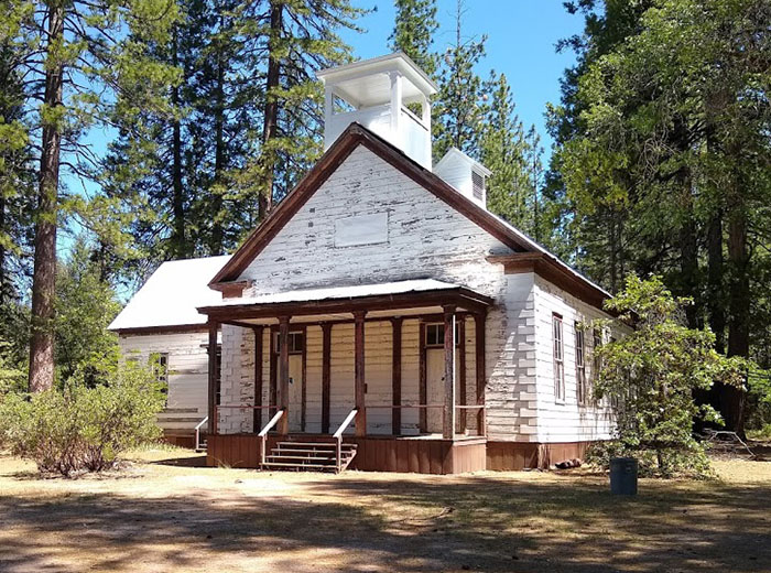
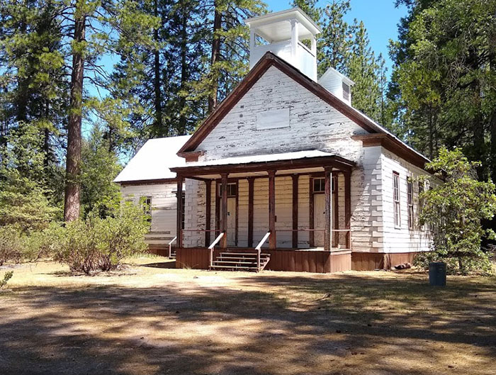
Originally the North Bloomfield Schoolhouse was built in 1857 but was not at this location, instead you would have found it near the day use picnic area. The schoolhouse that you see today was built around 1874 and was sourced through the townspeople for a cost of $3,700. It was completely furnished and had a library. Classes were given to children from Kindergarten all the way to 8th grade by 2 teachers.
Currently the schoolhouse is boarded up and unfortunately vandals have been inside. It appears that there is some rehabilitation work going on. I will add an update once I get further information.
There's Even More To See:
The 5 places I mentioned above are not all to see. There are numerous other buildings still standing and in excellent state of historical preservation as well as other relics that are on their last leg before turning to dust.
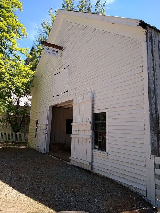
Kallenburgers Barbershop, Ostrums Livery Stable, the Cummins Hall that has been converted into the main office and museum for the Malakoff Park Station and others.
Blair Lake:
History Of The Lake:
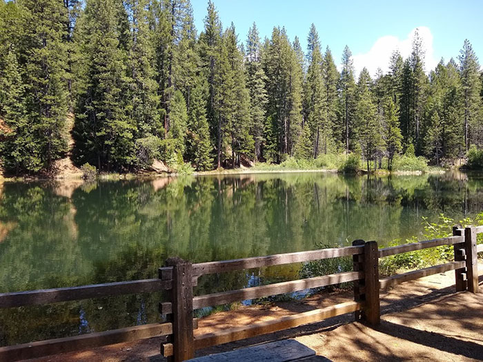
The beginnings of Blair lake wasn't exactly what you see here today. Originally the lake started out its mining life as a hydraulic mine and then a holding pond for water used in hydraulic mining. As it stands today, it is a great feature to the Malakoff Diggins State Historic Park.
Activites On The Water:
Over the years there has been an annual kids fishing derby, where young anglers can try their hand at catching rainbow trout, bluegill and bass. If you want to spend an afternoon on the lake you can swim, kayak or raft out on it, maybe after having lunch at one of the picnic tables.
Safety Stuff:
Note, the water is tested annually for mercy to make sure it is safe. Also, last time we went up there we encountered a bear swimming in it. So just be aware that there is wildlife in the area.
Chute Hill Campground:
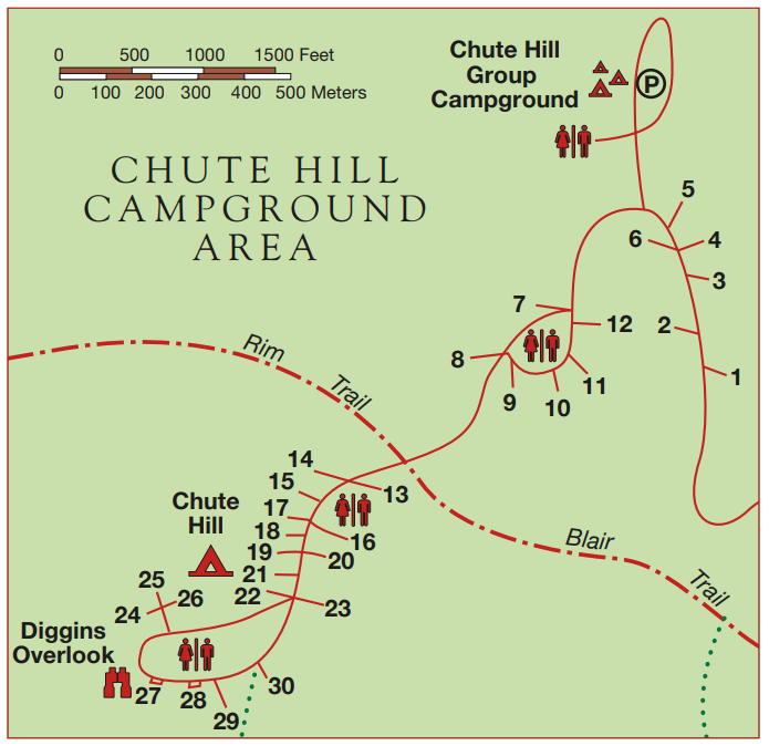
Chute Hill campground has a total of 30 tent sites and 1 large group camping area overall. It is located in Malakoff Diggins State Park and is really a campground that nobody really knows about but is a beautiful area with a lot of historical significance.
Campsite Fee:
$35 per night
Add. Vehicle Fee:
$8 per vehicle
Dogs:
Allowed in
certain areas
Season:
Year Round
# Of Sites:
30 Total
1 Group Site
3 Cabins
Showers:
No Showers
Water:
Yes, many spigots
around campground
Toilets:
4 bathrooms
Yes, flush toilets
Dump Station:
No
WiFi:
No WiFi Available
Cell Service:
Little To None
People Per Site:
8 Maximum
Check Out/In Times:
12:00pm/2:00pm
Campground Map:
Campsites:
All of the 30 campsites are mainly geared towards tent camping, but smaller RVs and camp trailers are welcome to stay here as well. The State Park's website states that trailers 18' and under are permitted, as well as campers and RVs that are under 24' in length.
There are a range of sites, some small and suitable for smaller tents and groups of people, while other sites are much larger and can accommodate larger tents with other accessories.
RV Sites:
It is not clear which sites are marked for RVs and which ones are for tent campers, but I do know that I did see some very different sizes when it came to parking pad sizes and campsite sizes.
If you go to reservecalifornia.com and look at the specs for each site, there is information on the parking pad size that will help you make a decision on what sites will better suit your needs.
Tent Sites:
All of the campsites are suitable for tent camping, but there were differences in the size of the sites, which would affect what size tent you can erect and how many tents you can put up too.
Some sites like sites 1, 3, 20, 21 and 23 were large and could easily accommodate larger tent setups with additional accessories, like a quick shade canopy, so be aware of this.
Handicap Sites:
There were no sites that were clearly marked as ADA approved and I am not sure if they just were not marked or if there weren't any available. I will update this post if I find out any more information or if someone chimes in and clarifies.
Unique Sites:
There were a few different unique sites in the Chute Hill Campground and I wanted to lay those out for those of you out there that may have never been here before and wanted to get one of the better sites.
Diggins Overlook Sites:
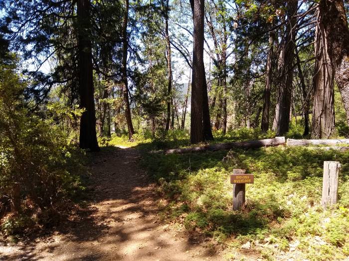
Sites 24, 25 and 27 have the best views of the Diggins Overlook point that you can make out through the trees. This is where you can see the cliffs that were washed away from hydraulic mining, with the different layers of the soil exposed.
As you can see from the image below, the trees do hinder the view quite a bit, but you can still get a good angle, if you walk closer and experience that one-of-a-kind view.
Group Camping Site:
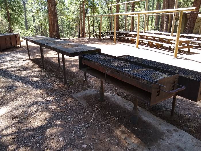
The group camping site (area) is large and private with its own area set apart from the rest of the campground, in fact, it has its own gate and loop. This is a larger area that has its own bathroom, parking lot and tons of picnic tables, tent areas and bbqs.
This is ideal for larger groups and can accommodate up to 40 campers (9 minimum) and 10 vehicles. The rates per night are set at $165 for this area and can be made on reservecalifornia.com.
Sites 24, 25 and 26:
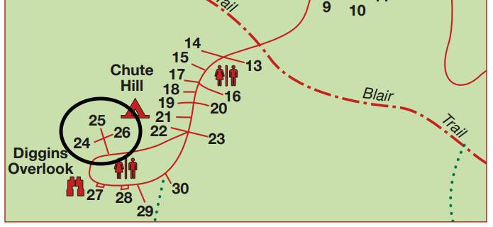
Sites 24, 25 and 26 are unique in the sense that they have their own separate little loop in the campground and are set apart from all of the other campsites in the area. They are smaller sites, geared mainly towards tent camping, but are much more private and have a partial view of the Diggins Overlook view.
Most Private Sites:
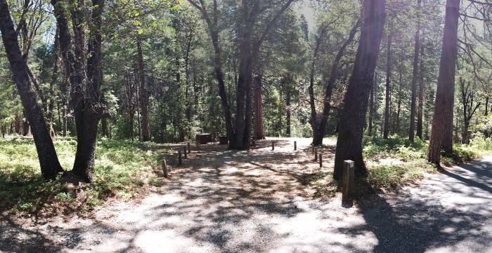
Sites 1, 2, 3, 8, 23, 24, 29 and 30: The listed sites are the most private sites we found in the campground and are probably the most popular because of that reason. These were set apart from other sites and had the most privacy, compared to the other sites.
More Private Sites (Site 1 Shown)
Campsite Features:
The campsite features include all of the basics like a large picnic table, fire rings and bear boxes. These are present at every site and are nice to have at your disposal when camping.
Picnic Table
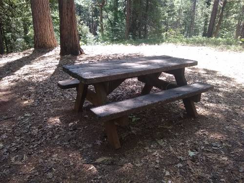
There are large picnic tables located at each campsite and several at the group site. These are just the standard picnic tables that can seat up to eight people and sometimes even 10, in a pinch.
From what I could tell, these were movable and not bolted or chained into the ground, so you can rearrange and move the table where you want to set up the picnic table.
Fire Rings
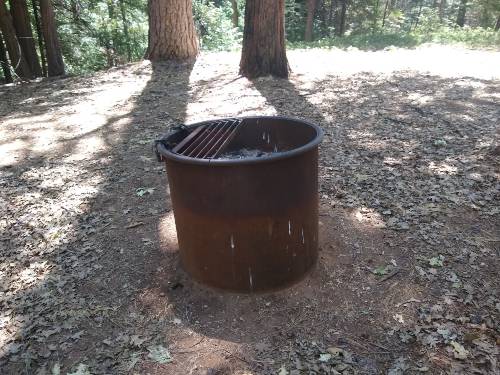
The fire rings I saw we're basically the standard fire rings that you see it almost every state park campground, the metal ones with the optional cooking grate that can be attached or detached.
These fire rings were a little bit taller though then some of the other ones I usually see, by about 12 inch or so, making them around 2 ft. tall in total.
Bear Box
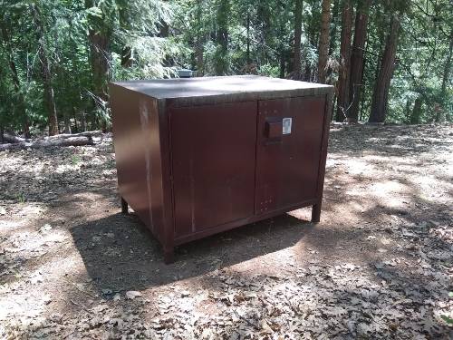
There are a lot of bears around the Malakoff Diggins area, so naturally you will have to store your food when you stay in the campground nearby.
Bear boxes are provided for each site and you are required to store all of your food and toiletries in these boxes to avoid any encounters that you might have with bears that are surely in the area.
Water Spigots
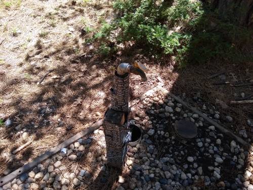
I typically will not write about water spigots in the campgrounds, but I only came across three spigots in the entire campground, so I thought it was worth mentioning.
The three different water spigot locations seem to be somewhere near the bathroom locations, making it somewhat available to most sites.
Bathrooms/Showers:
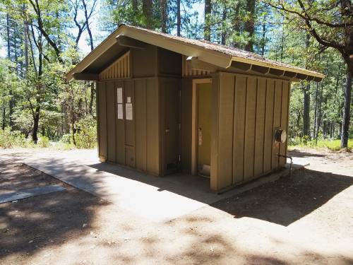
There are only three bathrooms in the entire campground plus one extra bathroom located in the group camping site, but it's not available to the other campsites, like the other three bathrooms are.
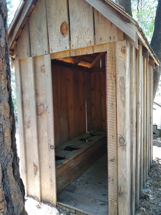
Each bathroom it's just a small building, like image shows, and there are two separate bathrooms in each building with flush toilets and sinks that have running water.
On our visit, the bathrooms were very clean and had all the amenities of home, including paper towels and hand soap, which most people like when camping.
Vehicles:
Vehicles are the same here as they are for every other state park, where you're allowed one vehicle per camp site that is included in the $35 a night fee and additional vehicles will be charged $8 for each additional vehicle.
Most of the parking pads are pretty large and can accommodate additional vehicles, but some sites do not have such large areas, so you will have to check the reservecalifornia.com website or call the park to verify the parking areas size.
Day Use Area:
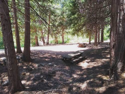
There is no specified day use area in the campground at self or in the historical area of the town, but there is a picnic area located in the historical town of North Bloomfield that has picnic tables, barbecue areas and bathrooms nearby, so it is the closest thing to a day use area that you will probably see.
The picture I posted shows this area, even though it's not very good, it is a very large area with many picnic tables and BBQ grills.
It is a nice area to sit down to have lunch with lots of shade and is located just behind the blacksmith building and there is even a trail from the campground that you can walk down to get to the day use area itself.
Cabins:
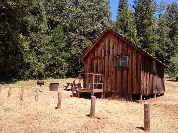
There are three different cabins you can rent out for a unique experience, going back in time a bit. These cabins are good for up to five people and they do not have any electricity and are equipped with bunk beds and a wood-burning stove to keep you warm. These can be reserved for $45 per night.
There are no bathrooms in these cabins either, you will have to use the bathrooms that are located nearby, in the day use area. These bathrooms do have flushing toilets and a sink.
Trails:
There are a few trails that you can take throughout the park. They meander in and around, so you can get a good feel for the area.
Keep in mind that there are bears up there and loads of poison oak to watchout for!
1. Blair Trail:
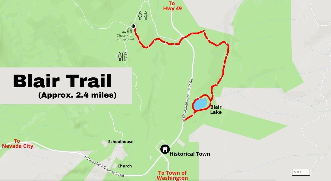
The loop around the lake starts at the parking lot, which is located just above the main street in town. This part of the loop if you are just looking for a little jaunt is approximately a little under half a mile (.5mile).
Optionally, if you are looking for a bit of a longer trail that includes the lake then you can start at the trailhead located in the campground right next to the campfire center. This trail is approximately 1.28 miles from the starting point to the loop around the lake.
2. Rim Trail:
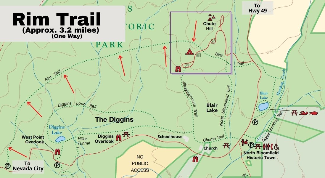
The Rim Trail runs from just after you enter the park and goes the length all the way over to humbug creek above Blair lake. It is 3.2 miles one way. It does get super hot up there during summer, so be sure to wear a hat and bring water for drinking. If you bring your dog, be sure to not let them swim in the diggings water, wait till you get over to Blair lake or Humbug Creek.
4. Diggins Loop:
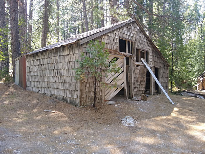
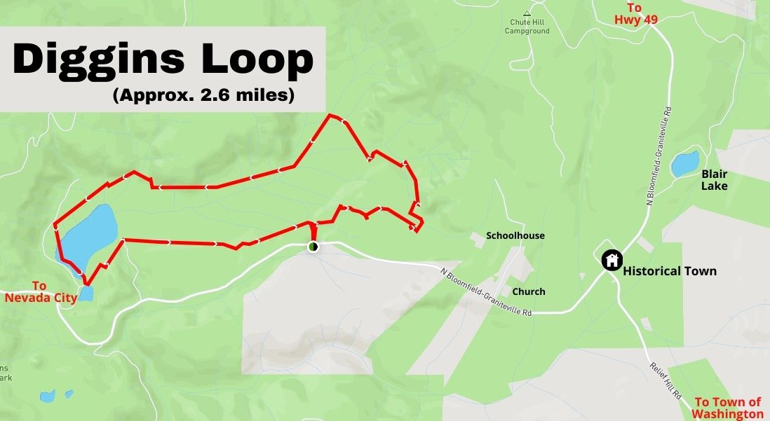
Though the trail is not well-marked, it is very easy to find your way through the area. Enter the trail on the North Bloomfield Grantieville Rd. It is near the old barn and the collapsed home.
4. Church Trail:
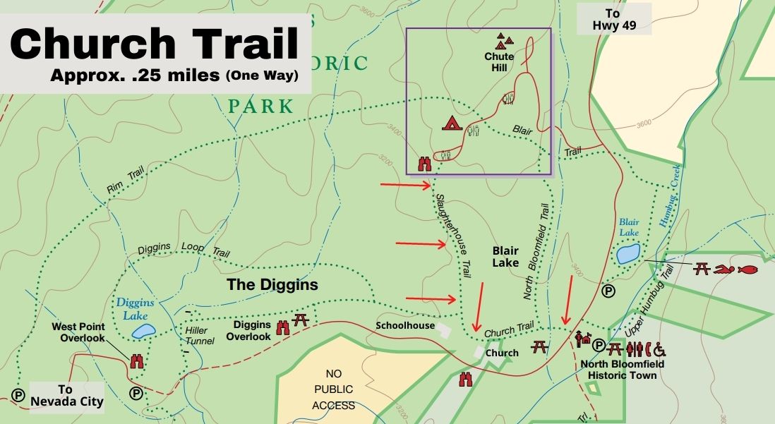
If you are looking to walk to the church and schoolhouse from the main historical area, then this is the trail you are looking for. The Church Trail is a little under .25 miles (one way) and takes you up near the cemetery and out to St. Columncille's Church and the North Bloomfield School.
The trailhead is just to the left of the day use BBQ, go past then and across the bridge. There you will see the trailhead sign.
As an option to this trail, then once you get to the cemetery you can hang a right and this is the "Slaughterhouse Trail". This trail takes you up to the campground. This section is approximately .61 miles, one way.
Helpful Resources:
In my research I came across many different resources, some better than others, and I wanted to list them here for you so you can check them out for yourself. These include the CA State Parks page, the brochure and the maps I found.


