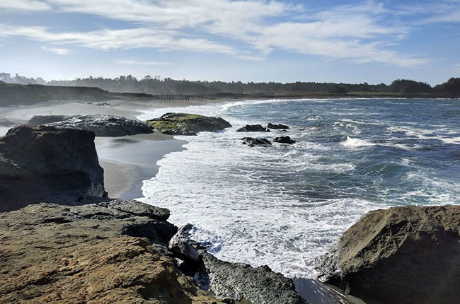
One of the most popular State Parks in Mendocino, MacKerricher State Park has so many things to offer. From whale watching, seals, historical train trestles, camping and nature preserve. All of this contained within the 9 miles of California Coast.
Weather Forecast For Fort Bragg:
Quick Information:
*Address: 24100 MacKerricher Park Rd, Fort Bragg, CA 95437
* Phone: 707 964-8898
* Elevation: 45 feet
* Established: 1949
* Size: 9 miles of Coastline
MacKerricher History:
Originally the land, now known as MacKerricher State Park, was known as El Rancho De La Laguna. It was purchased by Duncan MacKericher and his wife Jessie in 1868. Though Duncan and his wife died in the mid 1920's, the land was run by the MacKerricher family until it was deeded to the state of California for use as a park in 1949.
Laguna Point is still there, and it may be possible today to still see anchor pins and holes that once held pier pilings used for loading ships with lumber. Now, Laguna Point is a place to watch whales from during the winter months.
Campsite Fee:
$45 a day
Day use:
Free
Pets:
Allowed on leash &
attended at all times
Day Use at MacKerricher State Park:
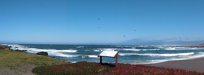
If you decide to visit the actual MacKerricher portion of the park, there is parking for day use. When we went there in December, it was closed as storms in late October had taken out a portion of the haul road. But previously you could, and probably can now, drive over to Laguna Point which is the day use area.
We did see a 40ft motor home headed out to park at Laguna Point, but honestly I was unsure if they would be able to navigate the turns. Its a bit narrow. Call over to the visitor center to ask them if there is parking for large rigs.
When we were there while the road out to Laguna Point was closed, we parked over in the Cleone Campground and walked the trail over to the beach. It basically put you on the same road to Laguna Point, but at the time it was closed to vehicles.
Campgrounds:
Showers:
Hot showers
($1 for 5 min.)
Potable Water:
Yes, many spigots around campground
Toilets:
Yes, flush toilets
Dump Station:
Yes
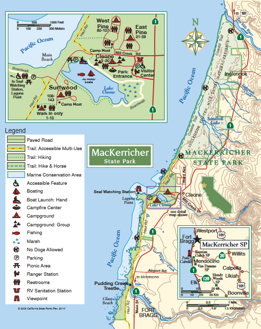
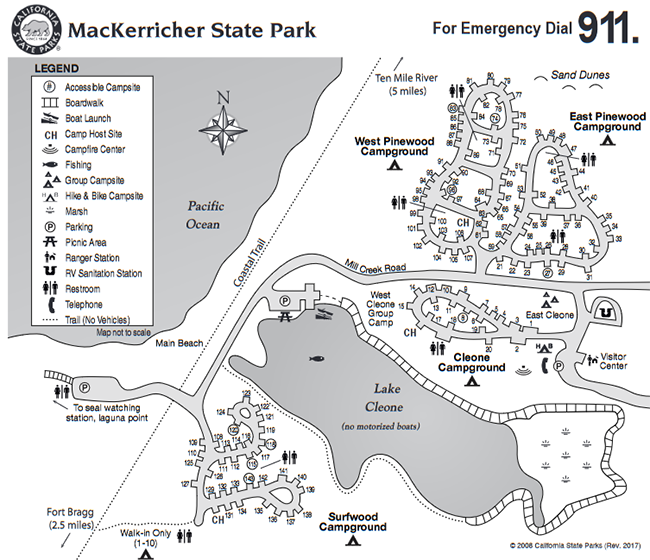
MacKerricher offers a multitude of different sites for your choosing, with a total of 153 sites over 4 different camping areas.
Cleone: Sites 1-20
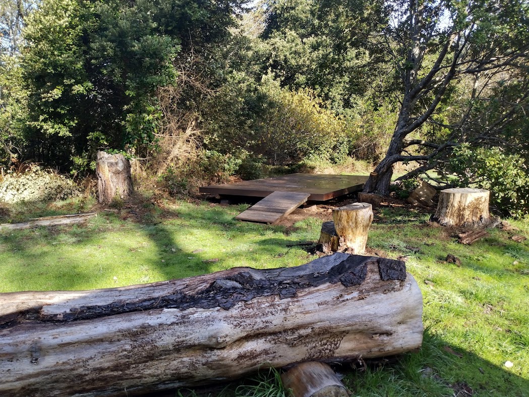
This area is the group area and consists of 20 sites, cabins as well as some sites have tent platforms.
East Pine: 21-59: PHOTOS COMING SOON
The East Pine Campground is for tents only and no generators are allowed.
West Pine: 60-107
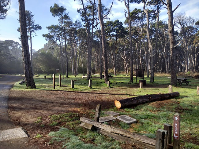
West Pine Campground can accommodate RVs, trailers and motor homes. This area is open year round and fills up quickly as many folks come through Fort Bragg in their rigs. There are trails located in each of the beachside campgrounds that can take you to the ocean. Some of the sites on the West Pine are located just a dune away from the ocean.
Surfwood: 108-143: COMING SOON PHOTOS
Surfwood: 1-10 for Walk-in only
What is there to do in MacKerricher?
Glass Beach:
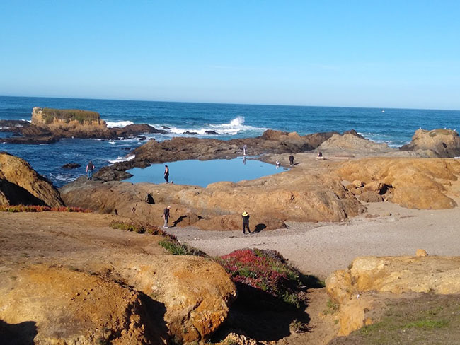
Between 1906 and 1967, the area now known as Glass Beach, was once the tow dump site. As shocking as that would be, especially in today's time..what we have been left with is some of an amazing seaside attraction.
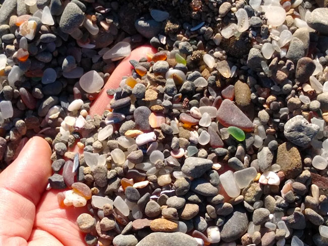
As the ocean waves crashed into what was the town dump, the glass that was thrown up was smashed and rounded and softened over many decades.
You may see many websites on this beach showing huge pieces of glass, but that isn't the case anymore, not to say that you couldn't score but. It has been picked through and since this area has become a part of the California State Park system, they say it is illegal to take anything from the beach.
Though there isn't nearly the amount there was once was, it is still a great place to take the kids to see what can be found. Access down to the beach is pretty easy if you stay to the right as you head out there.
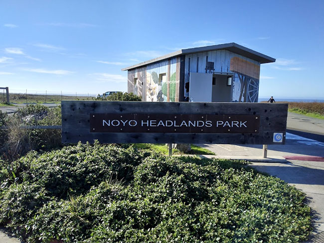
At the parking lot for Glass Beach, there is a restroom available. I am unsure as to the cleanliness of it, but it seems it was a very busy restroom. I did observe some folks look in then turn to see if the other side was cleaner.
Pudding Creek Trestle:
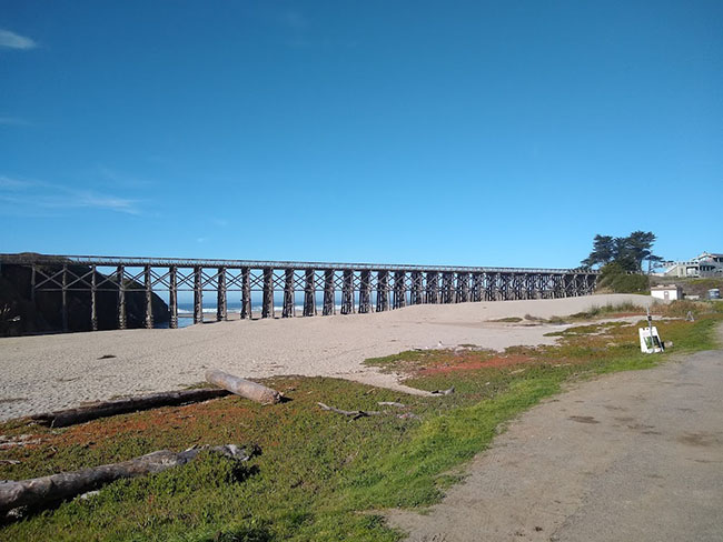
The Union Lumber Company built the 10-mile-long train trestle in 1916, When Mendocino County was in its height of its lumber industry. The train replaced the old ways of hauling the logs out to ships via horsepower. Between Fort Bragg and 10-Mile River were 42 logging camps. In fact, these camps were around dating back to the mid 1800's and ran from Navarro River and on up to Westport Union Landing.
The railroad ran from 1916 until 1949, when it was replaced by a haul road which ran for 8 miles along the coast. This was the main transportation for logging trucks until 1983.
Today the old train trestle, turned haul road, turned walking path is a wonderful place to get a birds eye view of Pudding Creek and the Pacific Ocean. Just down the street from Glass Beach you can park right at the beginning of the bridge, many folks enjoy watching the unobstructed sunset view from this location.
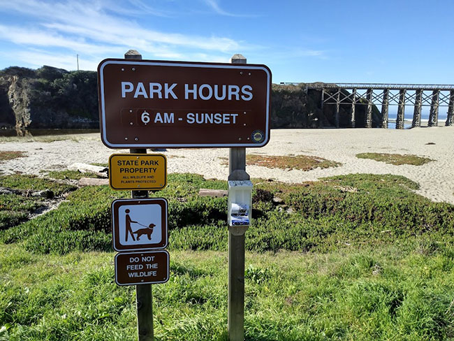
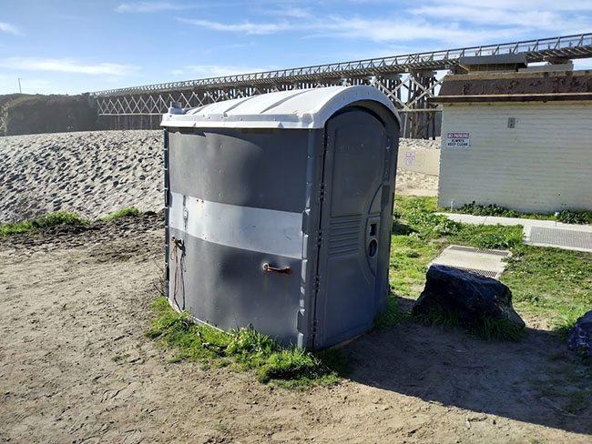
NOTE: There is one single portable toilet at this location. When we visited in early December, it was spotless.
But when we were there in mid-July, it was incredibly nasty. People had stopped using the toilet and were just using the inside of the restroom.
Inglenook Fen-Ten Mile Dune Natural Preserve:
This area located in the MacKerricher State Park has been set aside as to preserve these last remaining ecosystems located in the state of California. The dunes, which happen to be one of the last remaining pristine dunes in our state. Though the train trestle turned haul road did pass through there. Plans are in order to continue to remove the haul road and any non-native species.
The fen that is located in Inglenook is the last remaining fen in the state. A fen is a peat forming ecosystem, also known as a mire. This area along with the dunes is home to migratory birds that are listed as declining, the Western Snowy Plover. If you are a bird watcher, then this is the place to go during your stay at MacKerricher.
Lake Cleone:
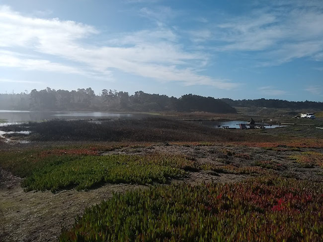
Before the haul road was built to replace the train trestle, Lake Cleone was fed by the ocean, forming a tidal lagoon. Once the haul road was installed, Lake Cleone became a 30 acre fresh water lake. Today, you can go out on the lake in a non motorized vessel, like kayak or canoe.
The lake does have a 1.3-mile trail that can take you completely around it. And if you are licensed or under 16, you can fish for bass in Lake Cleone.

There are a few hikes in the MacKerricher State Park worth doing. Check out below the few I have listed.
Haul Road Hike:
Walk the old haul road; Glass Beach to MacKerricher
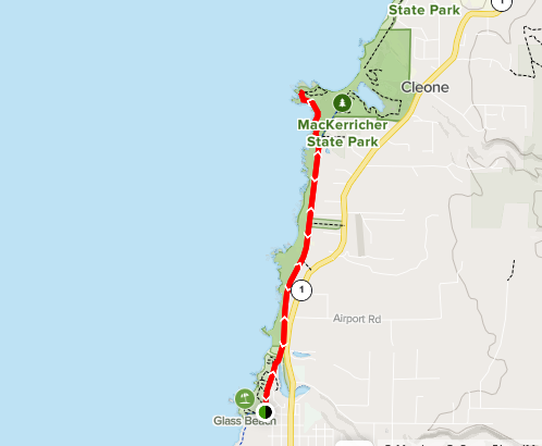
5.5 miles round trip. From Glass Beach to Laguna Point in MacKerricher this trail takes you along the original path that once hauled some of the largest redwood trees as they headed to Fort Bragg Mill. This road is washed out in a few places, but it is still navigable.
Ka Kahleh Trail: 4.9 miles round trip; easy and paved.
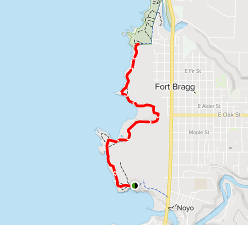
From Glass Beach and south to nearly Noyo inlet. So technically, this one begins in MacKerricher. It is nearly 5 miles total and paved. This one is great for strollers!
MacKerricher Beach:
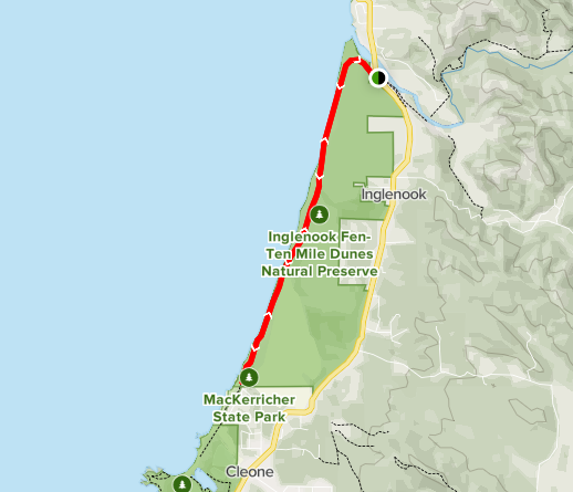
The hike from MacKerricher will take you a bit under 8 miles round trip. Hiking the California coast through Inglenook Fen 10 Mile Dunes over to 10 Mile River. The trail isn't super well-marked and there is potential to damage one of the last remaining untouched dunes in California. It may be best to try staying along the beach for this hike. You may get to view the Snowy Plovers or seals.
Helpful Resources:
If you would like to view more information on MacKerricher, check out some of these resources.
